Om Publications

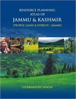
Resource Planning Atlas of Jammu & Kashmir: People Land & Forest: Jammu
Gurbakhsh Singh
₹0 ₹0 (20% off)
ISBN 13
9789380574226
Year
2013
‘Resources are not, they become’ is a famous doctrine propounded by Erich W.Zimmermann Resources in general and natural resources in particular need to be managed and planned in such a way that they become capable of feeding the billions along with satisfying their other needs and wants. Being universally true, the problem is most pressing for the developing world in general and India in particular. Managing the resources in a backward, hilly and mountainous state of Jammu and Kashmir is still more important.
It is in this context that the author, Prof. Gurbakhsh Singh, has taken up only three resources viz. people, land and forests of Jammu region of Jammu & Kashmir state for their assessment over time and space so that this assessment becomes handy for the future planning of these resources for their optimal utilization. He has taken large number of relevant and cogent parameters to discuss these resources. Besides, deliberating briefly on the environmental settings of study region he has dwelt upon various elements of population which greatly influence the use of the land. While discussing land as a resource all the nine categories of land use have been defined and discussed along with newly created tenth category-“The potential agricultural land” in their spatial and temporal context. Agricultural regionalization is based on four cogent parameters of agricultural productivity, ranking of crops, crop combination and crop diversification. Besides all this, levels of agricultural development have been obtained by selecting ten relevant variables. Forests are by far the most important resource of the study region and as such only four commercially important species based on four parametric angles viz distribution of areas, growing stock (a b h), density and volume of growing stock have been dealt with in such a way that future planners can be helped in taking decisions. All these aspects of three important resources are depicted by more than one hundred and seventy maps (plates) which give it a shape of an Atlas and make the work more comprehensive and authentic.